History
History-Trstenik Through the Ages
The history of Trstenik and its surroundings goes way back in the past. The area of the Municipality of Trstenik was populated during the Neolithic period, 6000 years before Christ. This is backed up by the archeological excavations of Blagotin and Stragari.
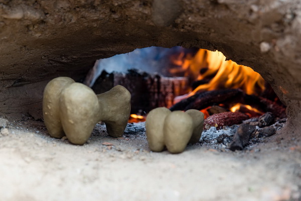
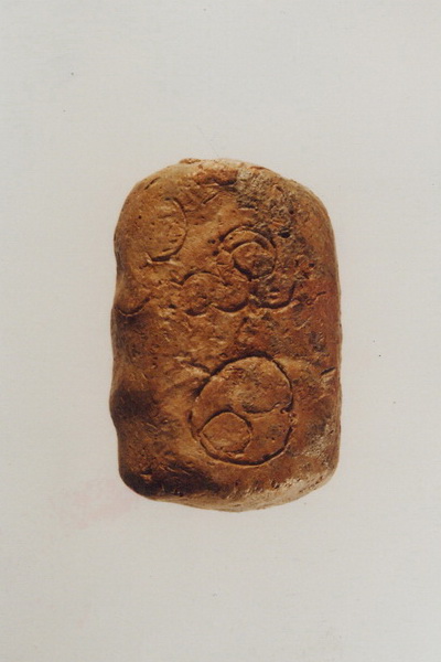
On Blagotin site, clay models of wheat (7-12cm in size) made from clay were found and which were a tribute to the fertility Goddess in the Blagotin Temple. On the back of one of the Model, the urban plan of the Blagotin Settlement is located, for which is believed to be the oldest urban plan in the world.
In times of antiquity culture, near Zapadna Morava River, tribe Tribali lived. Herodotus notes in V century BC that through Tribal plain Angros river flows through (Zapadna Morava).
During I century BC, these areas are conquered by Romans. The Zapadna Morava River valley and Trstenik area gain and enormous significance, because this was the main communication zone between the roman provinces. From the Roman period and Castrate in place Strazba, on the right bank of the river. Greates contributions Romans give this area was in the III century AD, when Grapevine from Apennine was brought, so that viticulture through the centuries becomes one the most important activity of the populace.
On the left bank of the Morava, above the Sutjeska, Byzantine emperor Justinian builds the city of Grabovac in 6th century, and this is the proof how big of the strategic point the Zapanda Morava valley had.
The first written notion of Trstenik is located in the gifted praise to monastery Ravanica, with which the Prince Lazar in 1381, gifts to his endowment the convents of Trstenik and Veluce. From the middle age period, monasteries of Morava architectonic school exist, Ljubostinja and Veluce.
In 1427, Turks conquer Krusevac, and as a border fortress towards Turkey, in Trstenik Sutjeska, city of Grabovac, later known as Jerina’s town has been rebuild and expanded. After Serbia fell to the Turkish rule in 1459, Trstenik becomes the road settlement in which the crew for securing the Turkish caravans is located.
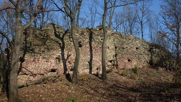
In the report of the Austrian intelligence officer Mitzeser, who travelled Serbia in 1784, Trstenik has been described in-detail as a small oriental town with 47 Turkish and 17 orthodox houses, with stone mosque two temples and several craftsman stores. It was located 2km west of today’s city in the village Osaonica, better known to the older generations as Stara Carsija.
After Milos Obrenovic approved, between 1832 and 1838, new Trstenik is being built on the spacious river bed of Morava, on the place which is convenient for expansion and city development. Trstenik town se steadily expanding, so it becomes the center of the today’s municipalities Vrnjacka Banja. The center of this new town was the city square with the alive market, church, craftsman stores, taverns. Respectable merchants build their houses in which base floors were stores. One that house is the house of Petar Katic, merchant and the member of the Assembly during the second half of the 19th century.
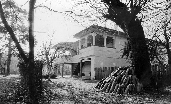
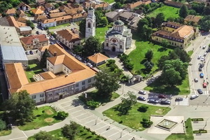
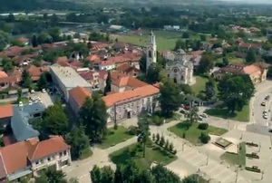
Austrian engineer who worked for the Serbian Government, Franz Vinter and Nikola Pasic, later to become the Prime Minister of the Kingdom of Serbia, made the first regulative plan of Trstenik. During the 1870s, Trstenik receives the new elementary school, paved city square and later a post office, pharmacy, banks and steam mill as a first industrial facility. Gravitational area of the city is expanding, trade with Levac and Sumadija is faster and better, so the building across the Morava becomes a MUST. 1899 was the year in which the construction of the steel bridge was completed, thanks to the respected resident of Trstenik, Vasa Andjelkovic and General Jovan Belimarkovic, who personally went to see the King Aleksandar Obrenovic. In the same year, in Trstenik the building of the Holy Trinity church was also finished, with the bell tower still being the highest in all of Serbia.
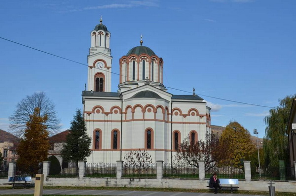
On the steep increase of the exports of agricultural and craftsman products and the economic development of the entire area, the contstruction of the railway Stalac-Kraljevo in 1910 had great impact. Trstenik is connected with not only Serbia cities but with Austria and other European countries.
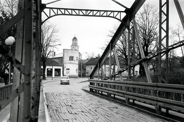
After the First World Was, the patriarchal town changes its shape along with the time. Today old city core, partially preserved, mostly dates to this period.
After the Second World Was, the further development is guaranteed by establishing a company “Prva Petoletka” which after the first decade of doing business becomes the leader in the fields of Hydraulics and Pneumatics in the SFR Yugoslavia, and it also becomes a brand on the world market.
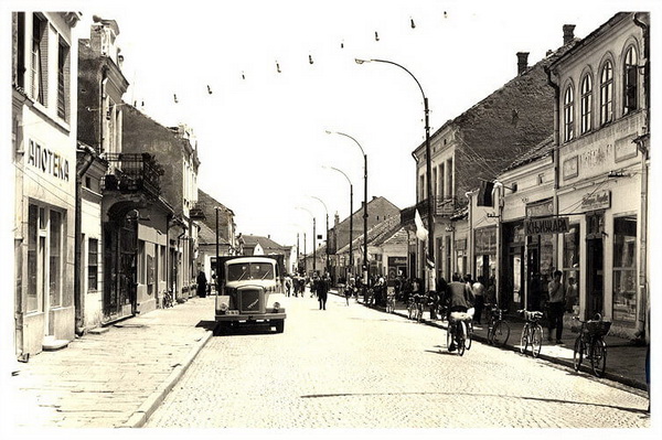
With the industrial development and the immigration of the population because of the need for work, Trstenik receives the look of modern industrial city with residential buildings, skyscrapers, square, park, sports objects and sports airfield. The surrounding of the city is oriented towards agriculture: vegetable farming, fruit farming, viticulture, and in the constant rise are vine making and rural tourism.
The newest modern look the downtown Trstenik receives is in the period after 2011.
